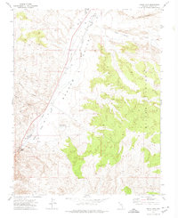
1972 Map of Indian Cove
USGS Topo · Published 1974About this map
1001 Ranch sits as the primary human landmark in this section of Lincoln County, situated in the arid drainage of the Meadow Valley Wash. This early 1970s survey captures a landscape defined by its vital water sources and transportation corridors. The Union Pacific railroad line runs parallel to the wash, following the low ground through the valley as it navigates the terrain between Miller Bench and the western foothills. The map documents a sparsely populated but active ranching and rail landscape, where specialized features like the Oxborrow Ranch Landing Field and various named springs such as Indian Cove and Miller Spring suggest the essential infrastructure required for life and travel in the high desert of eastern Nevada.
Find a feature on this map
1 named feature on this map. Tap any name to fly to it.
Don’t see what you’re looking for? This feature index may not catch every label — zoom into the map to look around manually.
Map Details
Editions of this 1972 Indian Cove Map
This is the sole edition of this map. No revisions or reprints were ever made.
Other maps of this area

1885 · Pioche
USGS Topo · 1:250,000

1886 · Pioche
USGS Topo · 1:250,000

1916 · Highland
USGS Topo · 1:62,500

1918 · Highland
USGS Topo · 1:62,500

1921 · NW 1/4 Panaca
USGS Topo · 1:48,000

1954 · Caliente
USGS Topo · 1:250,000

1959 · Caliente
USGS Topo · 1:250,000
1970 · Bennett Pass
USGS Topo · 1:24,000
1970 · Caliente
USGS Topo · 1:24,000
1970 · Panaca
USGS Topo · 1:24,000