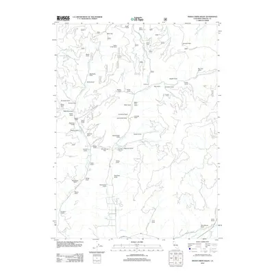
2012 Map of Indian Creek Baldy
USGS Topo · Published 2012About this map
Indian Creek Baldy rises over a landscape defined by an intricate network of deep gulches and creek drainages in Siskiyou County. The area’s complex drainage patterns are evident in the convergence of Deadwood Cr and Cherry Cr, while names like Hardscrabble Gulch and China Gulch hint at the region’s storied resource extraction history. The Deadwood Conservation Camp serves as a central landmark in this high-elevation terrain, situated near the headwaters of Clear Cr.
Find a feature on this map
70 named features on this map. Tap any name to fly to it.
Don’t see what you’re looking for? This feature index may not catch every label — zoom into the map to look around manually.
Map Details
Editions of this 2012 Indian Creek Baldy Map
This is the sole edition of this map. No revisions or reprints were ever made.
Other maps of this area

1886 · Shasta
USGS Topo · 1:250,000

1894 · Shasta
USGS Topo · 1:250,000

1932 · Yreka
USGS Topo · 1:96,000

1939 · Yreka
USGS Topo · 1:125,000

1948 · Weed
USGS Topo · 1:250,000

1950 · Weed
USGS Topo · 1:250,000

1954 · Yreka
USGS Topo · 1:62,500

1955 · Condrey Mtn
USGS Topo · 1:62,500
1955 · Hornbrook
USGS Topo · 1:62,500
1955 · Fort Jones
USGS Topo · 1:62,500