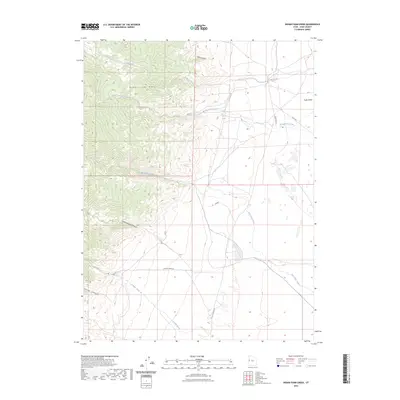
2023 Map of Indian Farm Creek
USGS Topo · Published 2023About this map
The Deep Creek Range dominates this landscape, where steep elevation drops into the expansive Snake Valley. This region in Juab County is defined by its drainage systems, with Indian Farm Creek and Toms Creek cutting through the western mountains toward the valley floor. High-altitude features like Dell Canyon and Cottonwood Canyon suggest the seasonal water movement that has shaped the alluvial fans visible at the mountain base.
Find a feature on this map
15 named features on this map. Tap any name to fly to it.
Don’t see what you’re looking for? This feature index may not catch every label — zoom into the map to look around manually.
Map Details
Editions of this 2023 Indian Farm Creek Map
This is the sole edition of this map. No revisions or reprints were ever made.
Other maps of this area

1908 · Fish Springs
USGS Topo · 1:250,000

1910 · Fish Springs
USGS Topo · 1:250,000

1953 · Delta
USGS Topo · 1:250,000

1958 · Delta
USGS Topo · 1:250,000

1960 · Granite Mountain
USGS Topo · 1:62,500

1961 · Trout Creek
USGS Topo · 1:62,500

1962 · Delta
USGS Topo · 1:250,000

1972 · Mud Lake Reservoir
USGS Topo · 1:24,000
1972 · Ibapah Peak
USGS Topo · 1:24,000
1972 · Goshute Canyon
USGS Topo · 1:24,000