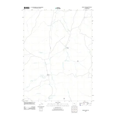
2012 Map of Indian Guide
USGS Topo · Published 2012About this map
S Fork Sybille Cr and its numerous tributaries dictate the character of this Laramie County landscape, carving through the terrain to form Waechter Canyon and Timber Canyon. In the early 21st century, water management is the primary visible imprint on the land, evidenced by a series of numbered reservoirs including Two Bar Number 1 Reservoir, Canon Number 1 Reservoir, and the Iron Mountain Reservoir. The settlement of Indian Guide sits in the southern portion of the map, served by the winding path of Sybille Rd. This map captures a ranching and water-retention landscape where names like East Canyon and Mule Cr suggest the historical and geographic priorities of the area. The intricate network of drainage, including the W Fork Iron Mountain Cr and Grant Cr, highlights the vital role of these seasonal and perennial waterways in high-plains geography.
Find a feature on this map
20 named features on this map. Tap any name to fly to it.
Don’t see what you’re looking for? This feature index may not catch every label — zoom into the map to look around manually.
Map Details
Editions of this 2012 Indian Guide Map
This is the sole edition of this map. No revisions or reprints were ever made.
Other maps of this area

1953 · Natwick SW
USGS Topo · 1:24,000

1954 · Cheyenne
USGS Topo · 1:250,000

1955 · Poe Mountain
USGS Topo · 1:24,000

1955 · Indian Guide
USGS Topo · 1:24,000

1955 · Guide Rock
USGS Topo · 1:24,000

1955 · Baldy Mountain
USGS Topo · 1:24,000

1955 · Sheep Rock
USGS Topo · 1:24,000

1955 · Goat Mountain
USGS Topo · 1:24,000

1958 · Cheyenne
USGS Topo · 1:250,000

1962 · Farthing
USGS Topo · 1:24,000