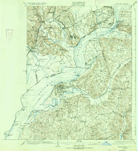
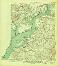
1925 Map of Indian Head
USGS Topo · Published 1934About this map
Indian Head Proving Grounds and military installations like Fort Humphreys and Fort Washington dominate this mid-1920s landscape along the Potomac River. This era shows a river-dependent economy transitioning toward modern road networks, with the Richmond Highway appearing alongside established water-based landmarks like Mattinglys Wharf, Proctors Wharf, and Poseys Wharf. The map provides significant detail for genealogists, identifying numerous rural schools such as the Potters Hill School, Lebanon School, and the uniquely named Granny Thompson School. Inland, the terrain is marked by traditional hubs like Pohick Church and Millards Mill, while the shoreline is defined by a series of named points including Possum Nose, Cockpit Pt, and Hallowing Pt, illustrating the intricate geography of the Maryland and Virginia borderlands before extensive suburban development.
Find a feature on this map
121 named features on this map. Tap any name to fly to it.
Don’t see what you’re looking for? This feature index may not catch every label — zoom into the map to look around manually.
Map Details
Editions of this 1925 Indian Head Map
6 editions found

Other maps of this area

1889 · Fredericksburg
USGS Topo · 1:125,000

1890 · Mt. Vernon
USGS Topo · 1:125,000

1891 · Mt. Vernon
USGS Topo · 1:125,000

1892 · Fredericksburg
USGS Topo · 1:125,000

1892 · Brandywine
USGS Topo · 1:62,500

1894 · Wicomico
USGS Topo · 1:62,500

1894 · Fredericksburg
USGS Topo · 1:125,000

1894 · Mt. Vernon
USGS Topo · 1:125,000

1895 · Wicomico
USGS Topo · 1:62,500

1895 · Brandywine
USGS Topo · 1:62,500