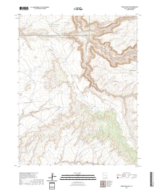
2023 Map of Indian Head Pass
USGS Topo · Published 2023About this map
Glen Canyon National Recreation Area dominates the northwestern portion of this high-desert plateau, where deep incisions like Sheep Canyon and Lean-To Canyon carve through the sedimentary layers of San Juan County. This modern 2023 survey illustrates a landscape of stark elevation changes, centered on the strategic crossing at Indian Head Pass. The network of unimproved routes, including Woodenshoe Rd and Fortknocker Canyon Rd, traces the accessible ridges between the sprawling drainage systems of Dark Canyon and Long Canyon.
Find a feature on this map
18 named features on this map. Tap any name to fly to it.
Don’t see what you’re looking for? This feature index may not catch every label — zoom into the map to look around manually.
Map Details
Editions of this 2023 Indian Head Pass Map
This is the sole edition of this map. No revisions or reprints were ever made.
Other maps of this area

1886 · Henry Mountains
USGS Topo · 1:250,000

1892 · Henry Mountains
USGS Topo · 1:250,000

1952 · Mouth of Dark Canyon
USGS Topo · 1:62,500

1952 · Mancos Mesa
USGS Topo · 1:62,500

1952 · Natural Bridges
USGS Topo · 1:62,500

1952 · Hite
USGS Topo · 1:62,500
1954 · White Canyon 1 NE
USGS Topo · 1:24,000

1954 · White Canyon 4 NE
USGS Topo · 1:24,000
1954 · White Canyon 1 SE
USGS Topo · 1:24,000
1954 · White Canyon 2 NE
USGS Topo · 1:24,000