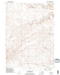
1990 Map of Indian Hill
USGS Topo · Published 1995About this map
Indian Hill rises as the central landmark of this Wyoming landscape, positioned along the border where Laramie County and Goshen County meet. The area is defined by a dendritic network of drainages, including Bear Creek, Little Bear Creek, and Cattail Creek, which cut through the high plains terrain. Human presence is concentrated around the Double Lazy J Ranch in the north and along the graded path of Indian Hill Road, which traverses the central portion of the quadrangle. This 1990s-era revision shows a working ranchland environment where water sources like a natural Spring and industrial infrastructure such as a Pipeline represent the essential elements of survival and commerce in the high desert.
Find a feature on this map
11 named features on this map. Tap any name to fly to it.
Don’t see what you’re looking for? This feature index may not catch every label — zoom into the map to look around manually.
Map Details
Editions of this 1990 Indian Hill Map
This is the sole edition of this map. No revisions or reprints were ever made.
Other maps of this area

1911 · Cheyenne
USGS Topo · 1:125,000

1914 · Cheyenne
USGS Topo · 1:125,000

1954 · Cheyenne
USGS Topo · 1:250,000

1958 · Cheyenne
USGS Topo · 1:250,000

1962 · Moffett Ranch
USGS Topo · 1:24,000

1962 · Lewis Ranch
USGS Topo · 1:24,000

1962 · Bristol Ridge NE
USGS Topo · 1:24,000

1963 · Little Indian Draw
USGS Topo · 1:24,000

1963 · C S Ranch
USGS Topo · 1:24,000
1963 · Cattail Ranch
USGS Topo · 1:24,000