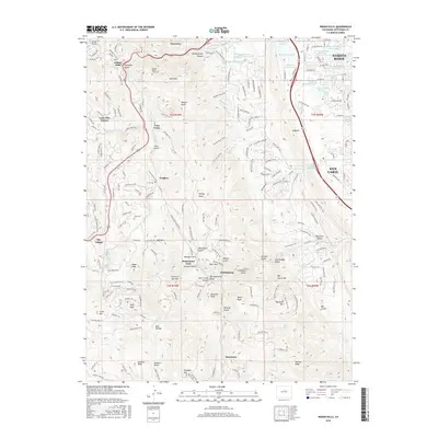
2016 Map of Indian Hills
USGS Topo · Published 2016About this map
Indian Hills and the residential enclaves south of Morrison characterize this transition between the Front Range peaks and the urban corridor. The landscape is defined by the prominent Dakota Ridge and Hogback formations to the east, which create a natural barrier for the drainage systems of Turkey Creek and Deer Creek. Settlement patterns follow the winding gulches, with communities like Homewood Park and Phillipsburg situated along narrow valley floors. Land use is a mix of protected open spaces and established residential developments, including the expansive Ken Caryl area and smaller mountain hamlets like Twin Forks and Sky Village. Local heritage is preserved in landmarks such as the Olinger Mount Lindo Cem and the Ault Cem, while the industrial history of the foothills is hinted at by features like Mica Mine Gulch. The map meticulously details a complex network of trails, including the Plymouth Creek Trail and Scenic View Trail, serving the many peaks such as Plymouth Mtn and Bill Couch Mtn.
Find a feature on this map
181 named features on this map. Tap any name to fly to it.
Don’t see what you’re looking for? This feature index may not catch every label — zoom into the map to look around manually.
Map Details
Editions of this 2016 Indian Hills Map
This is the sole edition of this map. No revisions or reprints were ever made.
Other maps of this area

1893 · Platte Canyon
USGS Topo · 1:125,000

1899 · West Denver
USGS Topo · 1:125,000

1938 · Morrison
USGS Topo · 1:24,000

1941 · Fort Logan
USGS Topo · 1:31,680

1942 · Morrison
USGS Topo · 1:31,680

1942 · Littleton
USGS Topo · 1:31,680

1945 · Indian Hills
USGS Topo · 1:31,680

1945 · Platte Canyon
USGS Topo · 1:24,000

1945 · Pine
USGS Topo · 1:24,000

1945 · Kassler
USGS Topo · 1:24,000