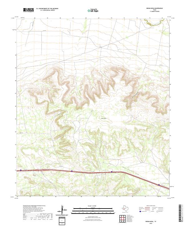
2022 Map of Indian Mesa
USGS Topo · Published 2022About this map
The Pecos River carves through the northern edge of this West Texas landscape, marking the boundary between Crockett and Pecos counties. This arid region is defined by complex drainage systems and high plateaus, most notably the broad expanse of Indian Mesa. The terrain is deeply incised by natural features such as Big Harkey Canyon and the wide path of Upper Fourmile Draw, which orient the movement of water and travelers alike through the limestone-dominated geography.
Find a feature on this map
10 named features on this map. Tap any name to fly to it.
Don’t see what you’re looking for? This feature index may not catch every label — zoom into the map to look around manually.
Map Details
Editions of this 2022 Indian Mesa Map
This is the sole edition of this map. No revisions or reprints were ever made.
Other maps of this area

1928 · Crane
USGS Topo · 1:125,000

1929 · Independence Draw Quadrangle
USGS Topo · 1:125,000

1954 · Pecos
USGS Topo · 1:250,000

1954 · Fort Stockton
USGS Topo · 1:250,000

1957 · Pecos
USGS Topo · 1:250,000

1958 · Fort Stockton
USGS Topo · 1:250,000

1969 · Indian Mesa
USGS Topo · 1:24,000
1969 · Indian Mesa SE
USGS Topo · 1:24,000

1969 · Bakersfield
USGS Topo · 1:24,000
1969 · Sherbino Ranch
USGS Topo · 1:24,000