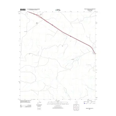
2012 Map of Indian Mesa SE
USGS Topo · Published 2012About this map
The high plains of Pecos County are defined by a landscape of scattered family ranching operations and petroleum extraction. Notable holdings such as the Claude Owens Ranch, Jeff Owens Ranch, and Perry Ranch mark the expansive territory, illustrating the enduring presence of private cattle and land management in this part of West Texas. The terrain is bisected by the Upper Fourmile Draw, which provides a natural drainage feature across the arid flats. Industrial activity is centered on the Priest Beavers Oil Field, reflecting the region's reliance on energy production. A modern transportation corridor cuts through the quadrangle, accompanied by a local Frontage Rd, connecting these isolated agricultural and industrial sites to the broader state road network.
Find a feature on this map
6 named features on this map. Tap any name to fly to it.
Don’t see what you’re looking for? This feature index may not catch every label — zoom into the map to look around manually.
Map Details
Editions of this 2012 Indian Mesa SE Map
This is the sole edition of this map. No revisions or reprints were ever made.
Other maps of this area

1929 · Sheffield
USGS Topo · 1:125,000
1929 · Independence Draw Quadrangle
USGS Topo · 1:125,000

1954 · Fort Stockton
USGS Topo · 1:250,000

1954 · Sonora
USGS Topo · 1:250,000

1958 · Sonora
USGS Topo · 1:250,000

1958 · Fort Stockton
USGS Topo · 1:250,000
1967 · Divide Country
USGS Topo · 1:24,000
1967 · Sheffield NW
USGS Topo · 1:24,000
1967 · Iraan
USGS Topo · 1:24,000
1969 · Smoky Mountain Ranch
USGS Topo · 1:24,000