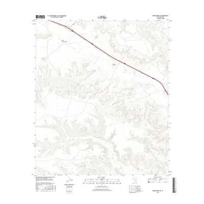
2016 Map of Indian Mesa SE
USGS Topo · Published 2016About this map
Upper Fourmile Draw and Fourmile Draw dominate the topography of this Pecos County landscape, where the ephemeral watercourses carve deep through the arid terrain. The map captures a section of West Texas defined by its dramatic relief and the modern transportation corridor that bisects the northern reach. This infrastructure is represented by the I10 Svc Rd, running parallel to the interstate as it cuts across the draws. The lack of named settlements or structures emphasizes the isolation of this region, focusing instead on the complex drainage patterns and elevation changes characteristic of the Stockton Plateau area.
Find a feature on this map
3 named features on this map. Tap any name to fly to it.
Don’t see what you’re looking for? This feature index may not catch every label — zoom into the map to look around manually.
Map Details
Editions of this 2016 Indian Mesa SE Map
This is the sole edition of this map. No revisions or reprints were ever made.
Other maps of this area

1929 · Sheffield
USGS Topo · 1:125,000
1929 · Independence Draw Quadrangle
USGS Topo · 1:125,000

1954 · Fort Stockton
USGS Topo · 1:250,000

1954 · Sonora
USGS Topo · 1:250,000

1958 · Sonora
USGS Topo · 1:250,000

1958 · Fort Stockton
USGS Topo · 1:250,000
1967 · Divide Country
USGS Topo · 1:24,000
1967 · Sheffield NW
USGS Topo · 1:24,000
1967 · Iraan
USGS Topo · 1:24,000
1969 · Smoky Mountain Ranch
USGS Topo · 1:24,000