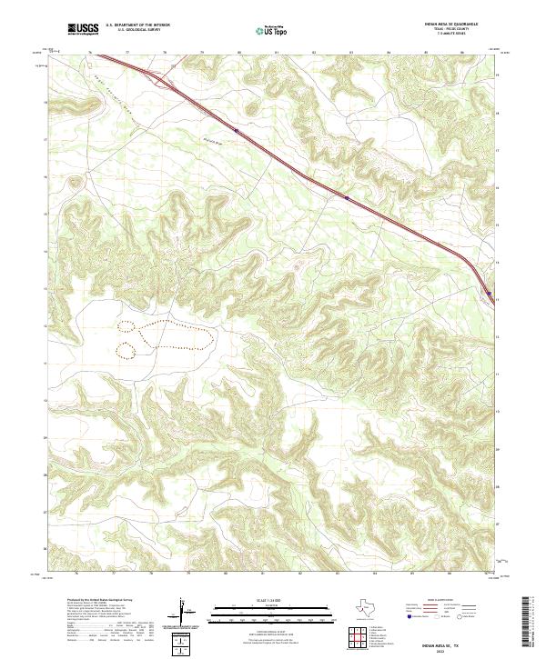
2022 Map of Indian Mesa SE
USGS Topo · Published 2022About this map
Fourmile Draw serves as the primary drainage through this arid stretch of Pecos County, cutting a prominent path through the high desert topography. This modern survey illustrates the persistent importance of natural watercourses in the Trans-Pecos region, even as modern infrastructure like the I10 Svc Rd now dictates the movement of people across the landscape. The terrain is characterized by a dense network of dry washes and gullies that feed into Upper Fourmile Draw, showing the intricate erosion patterns typical of the West Texas mesa country. While the map is sparse in terms of permanent settlements, the proximity of these drainage systems to the primary transportation corridor highlights how historic transit routes in the Southwest often followed the natural grades established by these intermittent streams.
Find a feature on this map
3 named features on this map. Tap any name to fly to it.
Don’t see what you’re looking for? This feature index may not catch every label — zoom into the map to look around manually.
Map Details
Editions of this 2022 Indian Mesa SE Map
This is the sole edition of this map. No revisions or reprints were ever made.
Other maps of this area

1929 · Sheffield
USGS Topo · 1:125,000

1929 · Independence Draw Quadrangle
USGS Topo · 1:125,000

1954 · Fort Stockton
USGS Topo · 1:250,000

1954 · Sonora
USGS Topo · 1:250,000

1958 · Sonora
USGS Topo · 1:250,000

1958 · Fort Stockton
USGS Topo · 1:250,000

1967 · Divide Country
USGS Topo · 1:24,000

1967 · Sheffield NW
USGS Topo · 1:24,000
1967 · Iraan
USGS Topo · 1:24,000
1969 · Smoky Mountain Ranch
USGS Topo · 1:24,000