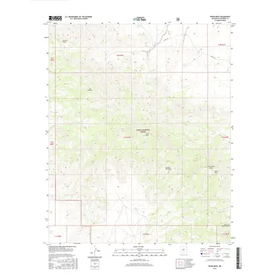
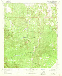
2017 Map of Indian Mesa
USGS Topo · Published 2017About this map
The Cibola National Forest encompasses much of this high-altitude landscape, where the Gallinas Mountains and Indian Mesa define the local topography. This 2017 survey details a network of water resources vital to this arid region, from natural features like Casimero Spring and North Lake to man-made catchments such as Pinto Tank, Roberts Tanks, and Rene Tank. The terrain is deeply incised by drainage systems including Jaramillo Canyon and Long Canyon, illustrating the complex erosional patterns of the New Mexico interior. Transportation is limited to functional routes such as Martin's Rd and Co Rd 1, which connect the scattered water points and range lands. The map provides a contemporary record of land use within the township and range system, showing how vital springs and tanks are positioned relative to the canyon bottoms and mesa tops.
Find a feature on this map
28 named features on this map. Tap any name to fly to it.
Don’t see what you’re looking for? This feature index may not catch every label — zoom into the map to look around manually.
Map Details
Editions of this 2017 Indian Mesa Map
This is the sole edition of this map. No revisions or reprints were ever made.
Other maps of this area

1954 · Socorro
USGS Topo · 1:250,000

1958 · Socorro
USGS Topo · 1:250,000
1962 · Socorro
USGS Topo · 1:250,000
1964 · Indian Mesa
USGS Topo · 1:24,000
1964 · Table Mountain
USGS Topo · 1:24,000
1964 · Dog Springs
USGS Topo · 1:24,000
1964 · Gallinas Peak
USGS Topo · 1:24,000
1964 · Puertecito
USGS Topo · 1:24,000
1964 · Lion Mountain
USGS Topo · 1:24,000
1964 · Indian Spring Canyon
USGS Topo · 1:24,000