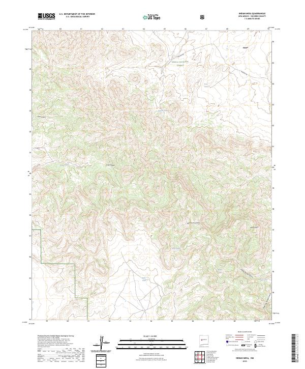
2023 Map of Indian Mesa
USGS Topo · Published 2023About this map
Alamo sits in the northeast corner of this high-altitude landscape, where the northern reaches of the Gallinas Mountains meet the high tablelands. This region, largely protected within the Cibola National Forest, is defined by a series of dramatic geographic features including the prominent Indian Mesa and deeply carved drainages such as Old Canyon and Long Canyon. The distribution of water is critical in this arid environment, evidenced by a network of ranching and wildlife infrastructure such as Pinto Tank, Roberts Tanks, and Rene Tank. The terrain transitions into significant canyon systems like Indian Spring Canyon and Three Log Spring Canyon as the elevation drops toward the south. Access is maintained by isolated routes like Martin's Rd and Co Rd 1, which trace the few viable paths through the complex topography of the mesa country.
Find a feature on this map
25 named features on this map. Tap any name to fly to it.
Don’t see what you’re looking for? This feature index may not catch every label — zoom into the map to look around manually.
Map Details
Editions of this 2023 Indian Mesa Map
This is the sole edition of this map. No revisions or reprints were ever made.
Other maps of this area

1954 · Socorro
USGS Topo · 1:250,000

1958 · Socorro
USGS Topo · 1:250,000

1962 · Socorro
USGS Topo · 1:250,000

1964 · Indian Mesa
USGS Topo · 1:24,000

1964 · Table Mountain
USGS Topo · 1:24,000

1964 · Dog Springs
USGS Topo · 1:24,000

1964 · Gallinas Peak
USGS Topo · 1:24,000

1964 · Puertecito
USGS Topo · 1:24,000

1964 · Lion Mountain
USGS Topo · 1:24,000
1964 · Indian Spring Canyon
USGS Topo · 1:24,000