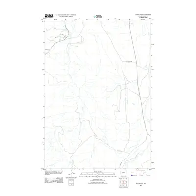
2012 Map of Indian Pass
USGS Topo · Published 2012About this map
The settlement of Indian Pass and its surrounding water infrastructure define the high desert plains of Park County in the early 21st century. This landscape is shaped by the complex distribution of water, evidenced by the Cody Canal and the Indian Pass Lateral, which cut across the terrain to support agriculture and settlement. The drainage network is equally prominent, with Sulphur Creek, Spring Creek, and Sage Creek carving natural paths through the open country. Local movement is facilitated by a grid of named routes like Arapahoe Trl, Reesy Rd, and the uniquely named Hoo Doo Ranch Rd. The map illustrates the contemporary balance between ranching land, natural arroyos such as Coal Creek, and modern utility infrastructure, including the Cody Landfill Rd.
Find a feature on this map
15 named features on this map. Tap any name to fly to it.
Don’t see what you’re looking for? This feature index may not catch every label — zoom into the map to look around manually.
Map Details
Editions of this 2012 Indian Pass Map
This is the sole edition of this map. No revisions or reprints were ever made.
Other maps of this area

1911 · Oregon Basin
USGS Topo · 1:62,500

1913 · Oregon Basin
USGS Topo · 1:62,500

1949 · Cody
USGS Topo · 1:62,500

1951 · Cody
USGS Topo · 1:62,500

1955 · Cody
USGS Topo · 1:250,000

1957 · Devils Tooth
USGS Topo · 1:62,500

1958 · Cody
USGS Topo · 1:250,000

1962 · Cody
USGS Topo · 1:250,000

1966 · Corbett Dam
USGS Topo · 1:24,000

1980 · Carter Mountain
USGS Topo · 1:100,000