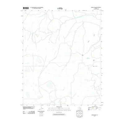
2010 Map of Indian Peak
USGS Topo · Published 2010About this map
Indian Peak dominates this section of the Texas Panhandle, overlooking a complex drainage network that feeds into the Prairie Dog Town Fork Red River. The landscape is defined by its deep incisions and canyons, including Johnson Canyon and Doley Canyon, which cut through the high plains. Water is a central element of the terrain, with prominent waterways like Indian Creek and Comanche Creek carving paths through the territory.
Find a feature on this map
13 named features on this map. Tap any name to fly to it.
Don’t see what you’re looking for? This feature index may not catch every label — zoom into the map to look around manually.
Map Details
Editions of this 2010 Indian Peak Map
This is the sole edition of this map. No revisions or reprints were ever made.
Other maps of this area

1954 · Plainview
USGS Topo · 1:250,000

1958 · Plainview
USGS Topo · 1:250,000

1960 · Indian Peak
USGS Topo · 1:62,500

1965 · Ross Canyon
USGS Topo · 1:24,000

1965 · Big Betty Reservoir
USGS Topo · 1:24,000

1965 · Silverton
USGS Topo · 1:24,000

1967 · Hay Lake
USGS Topo · 1:24,000

1967 · Lake Theo
USGS Topo · 1:24,000
1976 · Indian Peak SW
USGS Topo · 1:24,000
1976 · Indian Peak NW
USGS Topo · 1:24,000