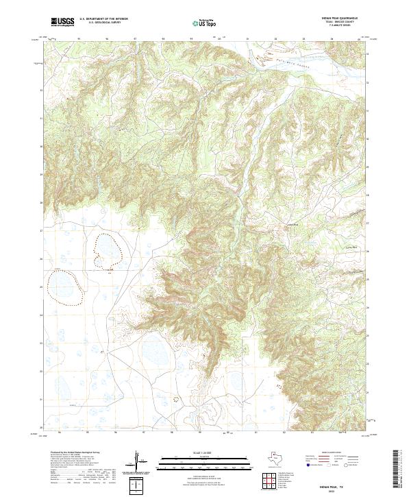
2022 Map of Indian Peak
USGS Topo · Published 2022About this map
Palo Duro Canyon dominates the northern reaches of this Briscoe County landscape, where the Prairie Dog Town Fork Red River carves through the High Plains. The terrain is defined by a complex network of drainage systems, including Comanche Cr, Indian Cr, and the converging flows of W Fork Dinner Cr and E Fork Dinner Cr. Rising above the breaks is the prominent landmark of Indian Peak, situated near the head of Folley Canyon. This 2022 survey illustrates a sparsely settled area primarily navigated via Co RD R and Co RD O, highlighting the transition from flat upland mesas to the deeply eroded caprock. Practical water sources for ranching or wildlife, such as Wild Horse Tank, are noted among the draws, including Cleveland Draw and the broad expanse of Folley Park.
Find a feature on this map
16 named features on this map. Tap any name to fly to it.
Don’t see what you’re looking for? This feature index may not catch every label — zoom into the map to look around manually.
Map Details
Editions of this 2022 Indian Peak Map
This is the sole edition of this map. No revisions or reprints were ever made.
Other maps of this area

1954 · Plainview
USGS Topo · 1:250,000

1958 · Plainview
USGS Topo · 1:250,000

1960 · Indian Peak
USGS Topo · 1:62,500

1965 · Ross Canyon
USGS Topo · 1:24,000

1965 · Big Betty Reservoir
USGS Topo · 1:24,000

1965 · Silverton
USGS Topo · 1:24,000

1967 · Hay Lake
USGS Topo · 1:24,000

1967 · Lake Theo
USGS Topo · 1:24,000
1976 · Indian Peak SW
USGS Topo · 1:24,000
1976 · Indian Peak NW
USGS Topo · 1:24,000