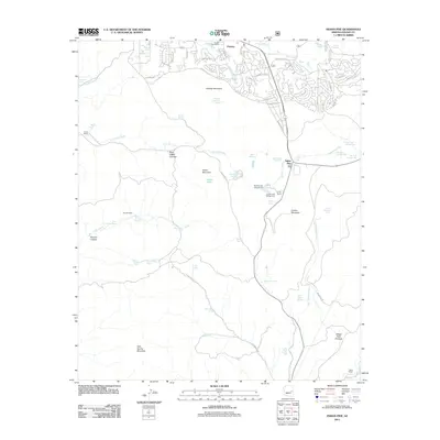
2011 Map of Indian Pine
USGS Topo · Published 2011About this map
Pinetop and Indian Pine anchor this portion of the Mogollon Rim country, where the development of recreational and residential communities meets a landscape shaped by volcanic peaks and high-altitude springs. Residential loops such as Bear Claw Ln and Ponderosa Pkwy indicate the 21st-century growth of Pinetop, while outlying landmarks like the Pinetop Post Office remain central to the local community. The terrain is defined by a series of prominent elevations, including Pinetop Mountain, Amos Mountain, and Cooley Mountain, interspersed with vital water sources such as Blue Grass Cienega and Bootleg Lake.
Find a feature on this map
78 named features on this map. Tap any name to fly to it.
Don’t see what you’re looking for? This feature index may not catch every label — zoom into the map to look around manually.
Map Details
Editions of this 2011 Indian Pine Map
This is the sole edition of this map. No revisions or reprints were ever made.
Other maps of this area

1886 · St Johns
USGS Topo · 1:250,000

1886 · Holbrook
USGS Topo · 1:250,000

1892 · St Johns
USGS Topo · 1:250,000

1893 · Holbrook
USGS Topo · 1:250,000

1954 · Holbrook
USGS Topo · 1:250,000

1954 · Clifton
USGS Topo · 1:250,000

1954 · Saint Johns
USGS Topo · 1:250,000

1954 · Mesa
USGS Topo · 1:250,000

1957 · Mesa
USGS Topo · 1:250,000

1957 · Holbrook
USGS Topo · 1:250,000