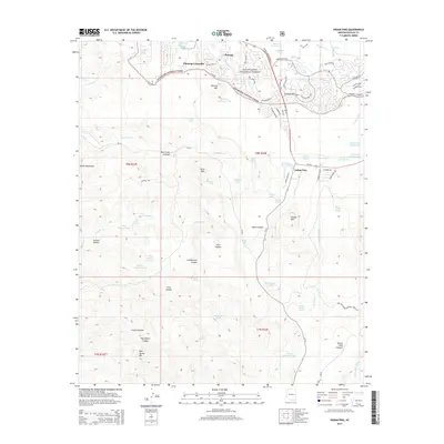
2014 Map of Indian Pine
USGS Topo · Published 2014About this map
Pinetop-Lakeside and the settlement of Pinetop occupy the northern reaches of this landscape, situated at the edge of the Sitgreaves National Forest. The map documents a transition from the developing road networks of Pinetop-Lakeside, including Ponderosa Pkwy and Branding Iron Loop, into the high-country drainage systems of the White Mountains. To the south, the terrain becomes increasingly defined by its hydrological management and dramatic topography, marked by numerous storage tanks like Milk Ranch Tank and W Indian Pine Tank. Prominent peaks such as Pinetop Mtn, Amos Mtn, and Cooley Mtn overlook a series of erosional features including Black Canyon and Post Office Canyon. The settlement at Indian Pine serves as a junction point between these distinct forest and canyon landscapes.
Find a feature on this map
92 named features on this map. Tap any name to fly to it.
Don’t see what you’re looking for? This feature index may not catch every label — zoom into the map to look around manually.
Map Details
Editions of this 2014 Indian Pine Map
This is the sole edition of this map. No revisions or reprints were ever made.
Other maps of this area

1886 · St Johns
USGS Topo · 1:250,000

1886 · Holbrook
USGS Topo · 1:250,000

1892 · St Johns
USGS Topo · 1:250,000

1893 · Holbrook
USGS Topo · 1:250,000

1954 · Holbrook
USGS Topo · 1:250,000

1954 · Clifton
USGS Topo · 1:250,000

1954 · Saint Johns
USGS Topo · 1:250,000

1954 · Mesa
USGS Topo · 1:250,000

1957 · Mesa
USGS Topo · 1:250,000

1957 · Holbrook
USGS Topo · 1:250,000