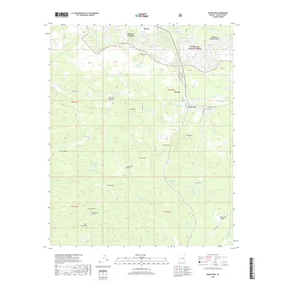
2018 Map of Indian Pine
USGS Topo · Published 2018About this map
Pinetop-Lakeside serves as the gateway to the high-country landscape of the Sitgreaves National Forest, where the transition from settlement to wilderness is clearly defined by a network of forest roads and canyons. The northern portion of the map is dominated by the established communities of Pinetop and Hondah, along with the recreational grounds of the Pinetop Country Club. These areas stand in contrast to the more remote southern terrain, characterized by deep natural features like Black Canyon and Post Office Canyon.
Find a feature on this map
80 named features on this map. Tap any name to fly to it.
Don’t see what you’re looking for? This feature index may not catch every label — zoom into the map to look around manually.
Map Details
Editions of this 2018 Indian Pine Map
This is the sole edition of this map. No revisions or reprints were ever made.
Other maps of this area

1886 · St Johns
USGS Topo · 1:250,000

1886 · Holbrook
USGS Topo · 1:250,000

1892 · St Johns
USGS Topo · 1:250,000

1893 · Holbrook
USGS Topo · 1:250,000

1954 · Holbrook
USGS Topo · 1:250,000

1954 · Clifton
USGS Topo · 1:250,000

1954 · Saint Johns
USGS Topo · 1:250,000

1954 · Mesa
USGS Topo · 1:250,000

1957 · Mesa
USGS Topo · 1:250,000

1957 · Holbrook
USGS Topo · 1:250,000