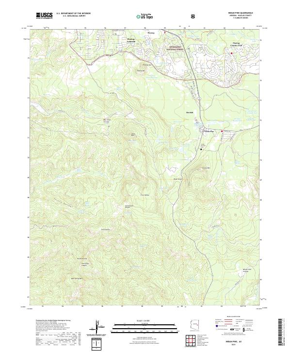
2021 Map of Indian Pine
USGS Topo · Published 2021About this map
Sitgreaves National Forest dominates this landscape on the Mogollon Rim, where the high-altitude terrain transitions into a complex system of drainage canyons and volcanic peaks. The northern edge of the sheet shows the developed communities of Pinetop-Lakeside and the Pinetop Country Club, while moving south reveals a more sparsely settled environment shaped by land-use patterns on tribal and forest lands. Significant topographic landmarks like Amos Mtn and Cooley Mountain overlook a series of seasonal drainages, including First Hollow and Second Hollow.
Find a feature on this map
82 named features on this map. Tap any name to fly to it.
Don’t see what you’re looking for? This feature index may not catch every label — zoom into the map to look around manually.
Map Details
Editions of this 2021 Indian Pine Map
This is the sole edition of this map. No revisions or reprints were ever made.
Other maps of this area

1886 · St Johns
USGS Topo · 1:250,000

1886 · Holbrook
USGS Topo · 1:250,000

1892 · St Johns
USGS Topo · 1:250,000

1893 · Holbrook
USGS Topo · 1:250,000

1954 · Holbrook
USGS Topo · 1:250,000

1954 · Clifton
USGS Topo · 1:250,000

1954 · Saint Johns
USGS Topo · 1:250,000

1954 · Mesa
USGS Topo · 1:250,000

1957 · Mesa
USGS Topo · 1:250,000

1957 · Holbrook
USGS Topo · 1:250,000