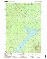
1988 Map of Indian Pond North
USGS Topo · Published 1988About this map
Indian Pond and the Kennebec River dominate this 1980s landscape in Somerset County, where the interior wilderness is defined by long-standing township boundaries and industrial logging routes. The settlement at Somerset Junction and the small station at Tarratine mark the intersection of traditional rail corridors with the water-driven geography of the north woods. The rugged elevation of Misery Ridge and Big Squaw Mountain provide a sharp contrast to the basin of Brassua Lake and the various streams feeding the pond, such as Churchill Stream and Falls Brook. Local infrastructure is visible through the Old Railroad Grade and scattered Sand & Gravel Pits, reflecting a period when this region was primarily utilized for resource extraction and forestry. The map also delineates the complex water management system of the river, including the West Outlet and Kennebec River East Outlet, vital for regulating the flow through this part of Maine.
Find a feature on this map
30 named features on this map. Tap any name to fly to it.
Don’t see what you’re looking for? This feature index may not catch every label — zoom into the map to look around manually.
Map Details
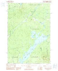
Editions of this 1988 Indian Pond North Map
2 editions found
Other maps of this area

1905 · The Forks
USGS Topo · 1:62,500

1907 · The Forks
USGS Topo · 1:62,500

1920 · Moosehead Lake
USGS Topo · 1:62,500

1921 · Brassua Lake
USGS Topo · 1:62,500

1922 · Moosehead Lake
USGS Topo · 1:62,500

1923 · Brassua Lake
USGS Topo · 1:62,500

1930 · Moosehead Lake
USGS Topo · 1:62,500

1944 · Brassua Lake
USGS Topo · 1:62,500

1944 · Moosehead Lake
USGS Topo · 1:62,500

1951 · Greenville
USGS Topo · 1:62,500
Featured Places
- Misery Gore, ME
- Sapling Township, ME
- Big Moose Township, ME
- Tarratine, Taunton & Raynham Academy Grant
- Somerset Junction, Misery Gore