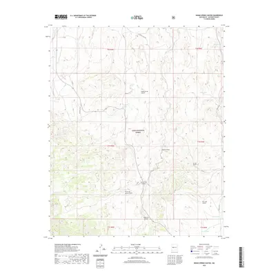
2020 Map of Indian Spring Canyon
USGS Topo · Published 2020About this map
Cibola National Forest encompasses a significant portion of this New Mexico landscape, which is defined by a dense network of drainage systems and intermittent water sources. The map highlights the rugged topography of Indian Spring Canyon, Three Log Spring Canyon, and Dove Spring Canyon, illustrating how the desert terrain is carved by seasonal water flow. Cattle ranching and land management legacy is evident in the numerous named tanks and springs, such as Earth Tank, Mexican Tank, and Montoya Spring, which serve as vital landmarks in an arid environment. Transportation through these canyons is facilitated by a grid of service roads, including Indian Svc Rte 7031 and Indian Svc Rte 54, alongside the winding Forest Rd 123. The presence of features like Maverick Draw and Corkscrew Canyon provides specific reference points for those studying the geomorphology or local land use history of Socorro County.
Find a feature on this map
37 named features on this map. Tap any name to fly to it.
Don’t see what you’re looking for? This feature index may not catch every label — zoom into the map to look around manually.
Map Details
Editions of this 2020 Indian Spring Canyon Map
This is the sole edition of this map. No revisions or reprints were ever made.
Other maps of this area

1954 · Socorro
USGS Topo · 1:250,000

1958 · Socorro
USGS Topo · 1:250,000

1962 · Socorro
USGS Topo · 1:250,000

1964 · Indian Mesa
USGS Topo · 1:24,000

1964 · La Jara Peak
USGS Topo · 1:24,000

1964 · Table Mountain
USGS Topo · 1:24,000

1964 · Silver Hill
USGS Topo · 1:24,000

1964 · Gallinas Peak
USGS Topo · 1:24,000

1964 · Puertecito
USGS Topo · 1:24,000

1964 · Lion Mountain
USGS Topo · 1:24,000