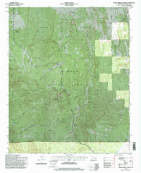
1995 Map of Indian Spring Canyon
USGS Topo · Published 1998About this map
The Alamo Band Indian Reservation and Cibola National Forest define this landscape in Socorro County, where high desert ranching and mining shaped the 1990s terrain. Remote outposts like Thomas Canada Ranch, Fretoso Ranch, and Hook Ranch are primary landmarks in a region defined by complex drainage systems, including Indian Canyon and Maverick Canyon. The importance of water in this arid environment is evident in the numerous improved sources such as Montoya Spring, Abbe Spring, and the Section 31 Well. The presence of the Hot Spot Mines and several isolated wells, such as the Middle Well near the New Mexico Base Line, indicates a landscape utilized for both mineral extraction and livestock grazing. This survey provides a look at the land use patterns within the reservation and forest boundaries before more recent ecological and cultural shifts.
Find a feature on this map
46 named features on this map. Tap any name to fly to it.
Don’t see what you’re looking for? This feature index may not catch every label — zoom into the map to look around manually.
Map Details
Editions of this 1995 Indian Spring Canyon Map
This is the sole edition of this map. No revisions or reprints were ever made.
Other maps of this area

1954 · Socorro
USGS Topo · 1:250,000

1958 · Socorro
USGS Topo · 1:250,000

1962 · Socorro
USGS Topo · 1:250,000

1964 · Indian Mesa
USGS Topo · 1:24,000

1964 · La Jara Peak
USGS Topo · 1:24,000

1964 · Table Mountain
USGS Topo · 1:24,000

1964 · Silver Hill
USGS Topo · 1:24,000

1964 · Gallinas Peak
USGS Topo · 1:24,000

1964 · Puertecito
USGS Topo · 1:24,000

1964 · Lion Mountain
USGS Topo · 1:24,000