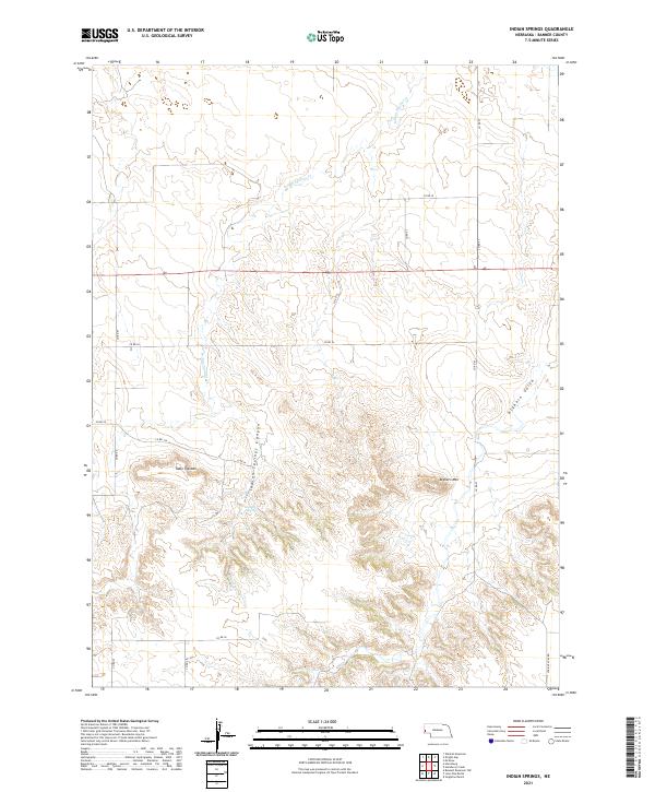
2021 Map of Indian Springs
USGS Topo · Published 2021About this map
Table Top Mtn and Bighorn Mtn define the high terrain of this Banner County landscape, where the High Plains break into complex drainage systems. The topography is shaped by the deep incision of Indian Springs Canyon and the winding course of Indian Springs Cr. This area is characterized by a sparse, rural road network typical of western Nebraska, including Co RD 57 and Wrights Gap Rd, which navigate the elevation changes between the flat tablelands and the eroded gulches. The drainage of Bighorn Gulch in the east and the eponymous Indian Springs highlight the importance of water sources in this arid environment. The map provides a detailed view of section lines and township boundaries, such as t19n r54w, which have dictated land use and property divisions in this region for generations.
Find a feature on this map
22 named features on this map. Tap any name to fly to it.
Don’t see what you’re looking for? This feature index may not catch every label — zoom into the map to look around manually.
Map Details
Editions of this 2021 Indian Springs Map
This is the sole edition of this map. No revisions or reprints were ever made.
Other maps of this area

1898 · Scotts Bluff
USGS Topo · 1:125,000

1898 · Camp Clarke
USGS Topo · 1:125,000

1954 · Scottsbluff
USGS Topo · 1:250,000

1958 · Scottsbluff
USGS Topo · 1:250,000

1965 · McGrew
USGS Topo · 1:24,000

1973 · Scotts Bluff 4 NW
USGS Topo · 1:24,000

1973 · Scotts Bluff 4 SE
USGS Topo · 1:24,000

1973 · Scotts Bluff 4 NE
USGS Topo · 1:24,000

1973 · Scotts Bluff 4 SW
USGS Topo · 1:24,000

1973 · Kimball 1 NE
USGS Topo · 1:24,000