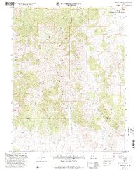
1998 Map of Indian Springs
USGS Topo · Published 2002About this map
The Simpson Mountains dominate this high-elevation landscape, where the border between Tooele Co and Juab Co crosses several remote peaks and canyons. Mapping here reveals a terrain defined by its water sources, with clusters of Springs such as Cherry Springs and Corral Spring providing critical water in an otherwise arid environment. The map details the complex drainage systems of Judd Creek, Lee Creek, and Meadow Creek, which carve deep canyons like Raul Canyon and Grassy Canyon.
Find a feature on this map
26 named features on this map. Tap any name to fly to it.
Don’t see what you’re looking for? This feature index may not catch every label — zoom into the map to look around manually.
Map Details
Editions of this 1998 Indian Springs Map
This is the sole edition of this map. No revisions or reprints were ever made.
Other maps of this area

1885 · Sevier Desert
USGS Topo · 1:250,000

1885 · Tooele Valley
USGS Topo · 1:250,000

1953 · Tooele
USGS Topo · 1:250,000

1953 · Delta
USGS Topo · 1:250,000

1955 · Simpson Springs
USGS Topo · 1:24,000

1955 · Indian Peaks
USGS Topo · 1:24,000

1955 · Indian Springs
USGS Topo · 1:24,000

1955 · Coyote Springs
USGS Topo · 1:24,000

1955 · Tooele
USGS Topo · 1:250,000

1958 · Delta
USGS Topo · 1:250,000