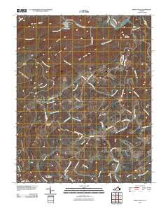
2010 Map of Indian Valley
USGS Topo · Published 2010About this map
Indian Valley and the surrounding Blue Ridge highlands are defined by a complex network of creeks and named ridges. The community centers around the Indian Valley Post Office, situated near the headwaters of Rans Creek and Greasy Creek. To the north, the landscape is marked by the Ottari Scout Camp Number Two Dam on Ottari Lake, a notable local landmark. The terrain is dominated by significant elevations such as Macks Mountain, Locust Thicket Mountain, and DeHart Mountain, which separate the various watersheds.
Find a feature on this map
54 named features on this map. Tap any name to fly to it.
Don’t see what you’re looking for? This feature index may not catch every label — zoom into the map to look around manually.
Map Details
Editions of this 2010 Indian Valley Map
This is the sole edition of this map. No revisions or reprints were ever made.
Other maps of this area

1889 · Hillsville
USGS Topo · 1:125,000

1890 · Dublin
USGS Topo · 1:125,000

1890 · Christiansburg
USGS Topo · 1:125,000

1891 · Dublin
USGS Topo · 1:125,000

1892 · Hillsville
USGS Topo · 1:125,000

1896 · Hillsville
USGS Topo · 1:125,000

1932 · Blacksburg
USGS Topo · 1:48,000

1937 · Blacksburg
USGS Topo · 1:62,500

1950 · Radford
USGS Topo · 1:62,500

1953 · Winston-Salem
USGS Topo · 1:250,000