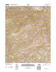
2013 Map of Indian Valley
USGS Topo · Published 2013About this map
Indian Valley and Copper Valley anchor this 2013 topographic study of the Blue Ridge highlands in Floyd County. The landscape is defined by the sharp transition from prominent peaks like DeHart Mountain and Bench Mountain down to the winding drainages of the Little River. The settlement pattern follows these narrow valleys and ridgelines, with local life centered along Indian Valley Rd and the scattered homesites linked by named family routes such as Simpkins Rd NW and Showalter Rd NW.
Find a feature on this map
71 named features on this map. Tap any name to fly to it.
Don’t see what you’re looking for? This feature index may not catch every label — zoom into the map to look around manually.
Map Details
Editions of this 2013 Indian Valley Map
This is the sole edition of this map. No revisions or reprints were ever made.
Other maps of this area

1889 · Hillsville
USGS Topo · 1:125,000

1890 · Dublin
USGS Topo · 1:125,000

1890 · Christiansburg
USGS Topo · 1:125,000

1891 · Dublin
USGS Topo · 1:125,000

1892 · Hillsville
USGS Topo · 1:125,000

1896 · Hillsville
USGS Topo · 1:125,000

1932 · Blacksburg
USGS Topo · 1:48,000

1937 · Blacksburg
USGS Topo · 1:62,500

1950 · Radford
USGS Topo · 1:62,500

1953 · Winston-Salem
USGS Topo · 1:250,000