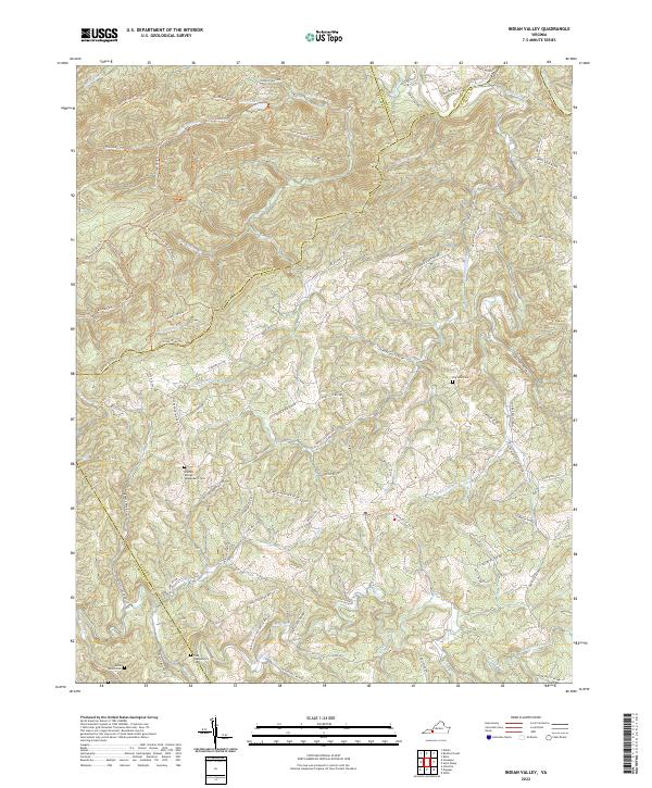
2022 Map of Indian Valley
USGS Topo · Published 2022About this map
The Little River meanders across the border of Montgomery and Floyd counties, anchoring a landscape defined by high ridges and deep drainages. This high-country region is marked by a network of family-named landmarks and quiet resting places, including the Big Sand Cem and the Captain George Quesenberry Cem. The terrain rises toward Bench Mountain Trl, while numerous small waterways like Big Indian Cr and Greasy Cr carve out the valleys. A complex system of forest trails and secondary roads, such as Macks Mountain Rd NW and 7 Mile Junction Trl, reveals the remote character of this corner of the Blue Ridge, where small mountain lakes like Ottari Lake sit tucked away from the main thoroughfares.
Find a feature on this map
88 named features on this map. Tap any name to fly to it.
Don’t see what you’re looking for? This feature index may not catch every label — zoom into the map to look around manually.
Map Details
Editions of this 2022 Indian Valley Map
This is the sole edition of this map. No revisions or reprints were ever made.
Other maps of this area

1889 · Hillsville
USGS Topo · 1:125,000

1890 · Dublin
USGS Topo · 1:125,000

1890 · Christiansburg
USGS Topo · 1:125,000

1891 · Dublin
USGS Topo · 1:125,000

1892 · Hillsville
USGS Topo · 1:125,000

1896 · Hillsville
USGS Topo · 1:125,000

1932 · Blacksburg
USGS Topo · 1:48,000

1937 · Blacksburg
USGS Topo · 1:62,500

1950 · Radford
USGS Topo · 1:62,500

1953 · Winston-Salem
USGS Topo · 1:250,000