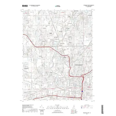
2019 Map of Indianapolis West
USGS Topo · Published 2019About this map
Indianapolis and its northwestern suburbs appear here in a complex network of residential enclaves and historic waterways. The White River and the Indianapolis Water Company Canal define the corridor between North Indianapolis and the enclave of Rocky Ripple, while the Central Canal Towpath provides a dedicated recreational link through the landscape. Genealogists will find the massive grounds of Crown Hill National Cem particularly notable, as it contains the Grave of President Harrison.
Find a feature on this map
183 named features on this map. Tap any name to fly to it.
Don’t see what you’re looking for? This feature index may not catch every label — zoom into the map to look around manually.
Map Details
Editions of this 2019 Indianapolis West Map
This is the sole edition of this map. No revisions or reprints were ever made.
Other maps of this area

1948 · Indianapolis East
USGS Topo · 1:24,000

1948 · Maywood
USGS Topo · 1:24,000

1948 · Beech Grove
USGS Topo · 1:24,000

1948 · Indianapolis West
USGS Topo · 1:24,000

1952 · Fishers
USGS Topo · 1:24,000

1952 · Carmel
USGS Topo · 1:24,000

1953 · Bridgeport
USGS Topo · 1:24,000

1953 · Zionsville
USGS Topo · 1:24,000

1953 · Clermont
USGS Topo · 1:24,000

1953 · Indianapolis
USGS Topo · 1:250,000
Featured Places
- Indianapolis, IN
- Speedway, Indianapolis
- Meridian Hills, Indianapolis
- Rocky Ripple, Indianapolis
- Wynnedale, Indianapolis