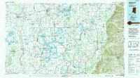
1994 Map of Indianola
USGS Topo · Published 1994About this map
The Yazoo Basin unfolds as a complex network of waterways and agricultural land in this mid-1990s record of the Mississippi Delta. Centered on Indianola, the landscape is defined by the winding paths of the Sunflower River, Bogue Phalia, and the Yazoo River, which dictated the early settlement patterns of towns like Belzoni and Moorhead. The map illustrates the region's reliance on both rail and road, showing the paths of the Columbus & Greenville Ry and the Illinois Central RR.
Find a feature on this map
95 named features on this map. Tap any name to fly to it.
Don’t see what you’re looking for? This feature index may not catch every label — zoom into the map to look around manually.
Map Details
Editions of this 1994 Indianola Map
This is the sole edition of this map. No revisions or reprints were ever made.
Other maps of this area

1909 · Wilsons Point
USGS Topo · 1:24,000

1913 · Wilson Point
USGS Topo · 1:31,680

1931 · Schlater
USGS Topo · 1:48,000

1933 · Lamont
USGS Topo · 1:62,500

1934 · Cleveland
USGS Topo · 1:62,500

1934 · Schlater
USGS Topo · 1:62,500

1936 · Greenwood
USGS Topo · 1:62,500

1939 · Lorenzen
USGS Topo · 1:62,500

1939 · Schlater
USGS Topo · 1:62,500

1939 · Readland
USGS Topo · 1:62,500