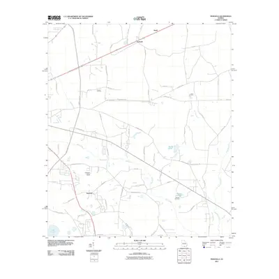
2011 Map of Indianola
USGS Topo · Published 2011About this map
Indianola and the neighboring settlements of Bandy and Newsome anchor this landscape on the eastern outskirts of Valdosta. The terrain is defined by the significant wetlands of Mud Swamp and the drainage of Otter Creek and Grand Bay Creek, illustrating the characteristic Lowndes County topography where land use must negotiate with expansive low-lying water systems. These natural features are interspersed with small-scale developments, including the Comanche Landing Airport and managed water bodies like Loch Laurel and Deloach Lake Dam.
Find a feature on this map
56 named features on this map. Tap any name to fly to it.
Don’t see what you’re looking for? This feature index may not catch every label — zoom into the map to look around manually.
Map Details
Editions of this 2011 Indianola Map
This is the sole edition of this map. No revisions or reprints were ever made.
Other maps of this area

1954 · Valdosta
USGS Topo · 1:250,000

1956 · Clyattville
USGS Topo · 1:24,000

1958 · Valdosta
USGS Topo · 1:250,000

1959 · Valdosta
USGS Topo · 1:250,000

1961 · Hahira East
USGS Topo · 1:24,000

1961 · Valdosta
USGS Topo · 1:24,000

1968 · Naylor
USGS Topo · 1:24,000

1971 · Indianola
USGS Topo · 1:24,000

1971 · Howell
USGS Topo · 1:24,000

1971 · Lake Park
USGS Topo · 1:24,000