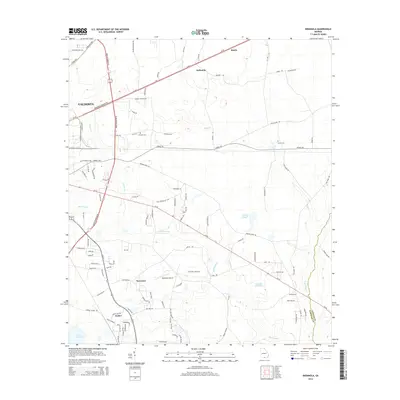
2014 Map of Indianola
USGS Topo · Published 2014About this map
Valdosta anchors the western edge of this coastal plain landscape, where the urban grid gives way to the wetlands and pine-scattered lowlands of the Echols and Lowndes County border. The area is defined by its complex drainage systems, most notably the winding paths of Mud Swamp and Grand Bay Creek, alongside distinct water bodies like Boring Pond and Loch Laurel. Small rural communities such as Indianola, Bandy, and Dasher are connected by a network of state and local routes, including the Wiregrass Georgia Pky. Local history is preserved in sites like Thomas Cem and Green Cem, while the presence of McClellan Airport suggests the continued utility of the flat, open terrain. This survey provides a clear view of the regional infrastructure before further modern development, documenting the proximity of agricultural life to the growing Valdosta periphery.
Find a feature on this map
109 named features on this map. Tap any name to fly to it.
Don’t see what you’re looking for? This feature index may not catch every label — zoom into the map to look around manually.
Map Details
Editions of this 2014 Indianola Map
This is the sole edition of this map. No revisions or reprints were ever made.
Other maps of this area

1954 · Valdosta
USGS Topo · 1:250,000

1956 · Clyattville
USGS Topo · 1:24,000

1958 · Valdosta
USGS Topo · 1:250,000

1959 · Valdosta
USGS Topo · 1:250,000

1961 · Hahira East
USGS Topo · 1:24,000

1961 · Valdosta
USGS Topo · 1:24,000

1968 · Naylor
USGS Topo · 1:24,000

1971 · Indianola
USGS Topo · 1:24,000

1971 · Howell
USGS Topo · 1:24,000

1971 · Lake Park
USGS Topo · 1:24,000