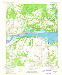
1971 Map of Indianola
USGS Topo · Published 1973About this map
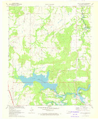
Eufaula Reservoir dominates the center of this landscape, its waters filling the Canadian River valley where the McIntosh Co Pittsburg Co line is marked as an indefinite boundary. To the south, the settlement of Indianola sits on the edge of Choate Prairie, a region defined by its rural social fabric of country churches and family burial grounds. Researchers can find several landmarks of community life, including the Choate Prairie Ch and its namesake Choate Prairie Cem, as well as Lone Oak Ch and New Hope Ch. The infrastructure of a previous era is still visible in the form of an Old Railroad Grade cutting across the terrain north of town. Along the northern hills of Burton, several oil and gas wells indicate the local industrial activity of the early 1970s.
Find a feature on this map
20 named features on this map. Tap any name to fly to it.
Don’t see what you’re looking for? This feature index may not catch every label — zoom into the map to look around manually.
Map Details
Editions of this 1971 Indianola Map
2 editions found
Other maps of this area

1900 · Canadian
USGS Topo · 1:125,000

1946 · Fort Smith
USGS Topo · 1:250,000

1962 · Raiford
USGS Topo · 1:24,000

1962 · Henryetta SW
USGS Topo · 1:24,000

1963 · Stidham
USGS Topo · 1:24,000

1965 · Fort Smith
USGS Topo · 1:250,000

1967 · Fort Smith
USGS Topo · 1:250,000
1971 · Crowder
USGS Topo · 1:24,000
1971 · Canadian
USGS Topo · 1:24,000
1971 · Lake Mc Alester
USGS Topo · 1:24,000