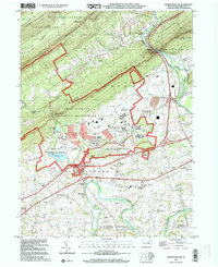
1999 Map of Indiantown Gap
USGS Topo · Published 2001About this map
Indiantown Gap Military Reservation dominates the landscape of Lebanon County, stretching across the base of Blue Mountain and First Mountain. This late-twentieth-century survey documents a dense concentration of military and civil infrastructure, from the Rifle Range and Muir Field to the sprawling Indiantown Gap National Cemetery. The map captures the meeting of rugged ridges and managed parklands, including Swatara State Park and Memorial Lake State Park, where the Union Canal and Union Canal Aqueduct trace the historical importance of the Swatara Creek corridor. Small communities and landmarks like Harper Tavern, Bordnersville, and Lickdale sit at the intersection of these recreational and military zones. Cultural details such as Moonshine Ch and Sattazahn Ch provide points of interest for genealogists tracing family roots in East Hanover and North Annville townships.
Find a feature on this map
60 named features on this map. Tap any name to fly to it.
Don’t see what you’re looking for? This feature index may not catch every label — zoom into the map to look around manually.
Map Details
Editions of this 1999 Indiantown Gap Map
This is the sole edition of this map. No revisions or reprints were ever made.
Other maps of this area

1891 · Lebanon
USGS Topo · 1:62,500

1892 · Lykens
USGS Topo · 1:62,500

1892 · Hummelstown
USGS Topo · 1:62,500

1892 · Pine Grove
USGS Topo · 1:62,500

1893 · Lykens
USGS Topo · 1:62,500

1893 · Lebanon
USGS Topo · 1:62,500

1899 · Lebanon
USGS Topo · 1:62,500

1924 · Hummelstown
USGS Topo · 1:62,500

1943 · Lebanon
USGS Topo · 1:62,500

1943 · Lykens
USGS Topo · 1:62,500
Featured Places
- East Hanover Township, PA
- Union Township, PA
- Swatara Township, PA
- McGillstown, East Hanover Township
- Indiantown, East Hanover Township