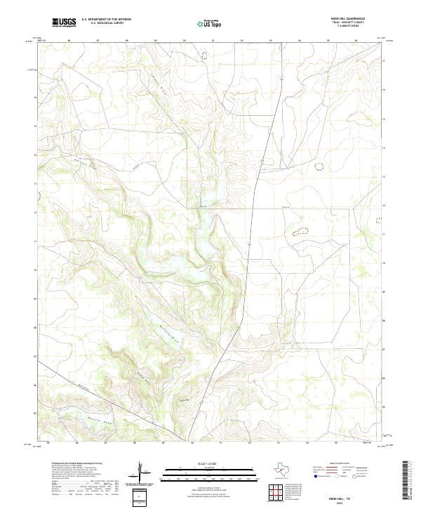
2022 Map of Indio Hill
USGS Topo · Published 2022About this map
Indio Hill rises as the central landmark in this high plains landscape of Crockett County, where the terrain is carved by a complex network of seasonal drainage patterns. The geography is defined by prominent ephemeral watercourses including Buffalo Draw, Johnson Draw, and Garrett Draw, which illustrate the natural watershed of the Edwards Plateau. Human infrastructure is sparsely overlaid on this rangeland, consisting primarily of utility-focused corridors such as Ranch Rd 865 and Co Rd 203. To the south, Wildcat Draw and Newton Draw further segment the land, showing the traditional movement of water toward the Pecos River basin. This survey provides a precise view of Texas back-country transit and topography, where ranching roads follow the level ground between these ancient erosional features.
Find a feature on this map
11 named features on this map. Tap any name to fly to it.
Don’t see what you’re looking for? This feature index may not catch every label — zoom into the map to look around manually.
Map Details
Editions of this 2022 Indio Hill Map
This is the sole edition of this map. No revisions or reprints were ever made.
Other maps of this area

1954 · Sonora
USGS Topo · 1:250,000

1958 · Sonora
USGS Topo · 1:250,000

1967 · Ozona
USGS Topo · 1:24,000

1967 · Double Mill Draw SE
USGS Topo · 1:24,000
1967 · Schneeman Draw NE
USGS Topo · 1:24,000

1967 · Indio Hill
USGS Topo · 1:24,000

1967 · Double Mill Draw NW
USGS Topo · 1:24,000

1967 · Crockett Heights
USGS Topo · 1:24,000
1967 · Double Mill Draw NE
USGS Topo · 1:24,000
1967 · Schneeman Draw SE
USGS Topo · 1:24,000