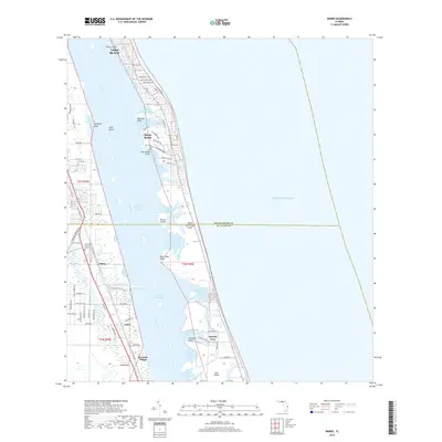
2018 Map of Indrio
USGS Topo · Published 2018About this map
Vero Beach and its surrounding barrier islands are documented here during a period of modern coastal development along the Indian River Lagoon. The map reveals the intricate shoreline of the Intracoastal Waterway, where numerous small coves and points like Little Starvation Cove and Crawford Point define the western edge of North Hutchinson Island. This survey captures the transition from the residential clusters of Indrio and Viking to the protected natural spaces of Jack Island.
Find a feature on this map
87 named features on this map. Tap any name to fly to it.
Don’t see what you’re looking for? This feature index may not catch every label — zoom into the map to look around manually.
Map Details
Editions of this 2018 Indrio Map
This is the sole edition of this map. No revisions or reprints were ever made.
Other maps of this area

1948 · Riomar
USGS Topo · 1:24,000

1948 · Indrio
USGS Topo · 1:24,000

1949 · Fort Pierce
USGS Topo · 1:24,000

1949 · Vero Beach
USGS Topo · 1:24,000

1949 · Oslo
USGS Topo · 1:24,000

1949 · Fort Pierce NW
USGS Topo · 1:24,000

1950 · Riomar
USGS Topo · 1:24,000

1950 · Fort Pierce
USGS Topo · 1:24,000

1950 · Fort Pierce NW
USGS Topo · 1:24,000

1950 · Oslo
USGS Topo · 1:24,000