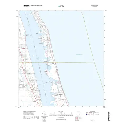
2021 Map of Indrio
USGS Topo · Published 2021About this map
Vero Beach and the shoreline of the Indian River Lagoon anchor this coastal survey, where the saltwater environment meets burgeoning residential development. The landscape is defined by the intricate finger-like extensions of the Indian River, including Little Starvation Cove, Hells Pocket, and Barkers Ditch Cove. This 2021 mapping shows a sophisticated network of recreational and heritage routes, such as the Florida Circumnavigational Paddling Trl and the Old Dixie Heritage Trl, which follow the historical corridors of the Atlantic coast.
Find a feature on this map
87 named features on this map. Tap any name to fly to it.
Don’t see what you’re looking for? This feature index may not catch every label — zoom into the map to look around manually.
Map Details
Editions of this 2021 Indrio Map
This is the sole edition of this map. No revisions or reprints were ever made.
Other maps of this area

1948 · Riomar
USGS Topo · 1:24,000

1948 · Indrio
USGS Topo · 1:24,000

1949 · Fort Pierce
USGS Topo · 1:24,000

1949 · Vero Beach
USGS Topo · 1:24,000

1949 · Oslo
USGS Topo · 1:24,000

1949 · Fort Pierce NW
USGS Topo · 1:24,000

1950 · Riomar
USGS Topo · 1:24,000

1950 · Fort Pierce
USGS Topo · 1:24,000

1950 · Fort Pierce NW
USGS Topo · 1:24,000

1950 · Oslo
USGS Topo · 1:24,000