
1951 Map of Inez NW
USGS Topo · Published 1953About this map
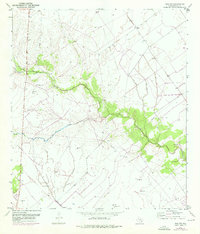
Garcitas Creek and Willow Creek meander through this rural section of Victoria County, marking a landscape defined by ranching and early energy development in the early 1950s. The presence of numerous windmills suggests a reliance on groundwater for livestock across the varied topography. Industrial activity is evident in the western reaches, where a Gas Collecting Station and scattered Gas Wells indicate the emergence of the local oil and gas economy. Cultural life is anchored by Salem in the north and Mt Pisgah Ch to the southeast, providing a view into the community's social fabric during this era. Infrastructure such as a Pipe Line and a dedicated Slush Pit further emphasize the transition toward petroleum production that was occurring alongside traditional land uses.
Find a feature on this map
12 named features on this map. Tap any name to fly to it.
Don’t see what you’re looking for? This feature index may not catch every label — zoom into the map to look around manually.
Map Details
Editions of this 1951 Inez NW Map
2 editions found
Other maps of this area

1951 · Inez
USGS Topo · 1:24,000

1952 · Marcado Creek
USGS Topo · 1:24,000

1952 · Victoria East
USGS Topo · 1:24,000

1953 · Beeville
USGS Topo · 1:250,000

1953 · Seguin
USGS Topo · 1:250,000

1956 · Beeville
USGS Topo · 1:250,000

1958 · Seguin
USGS Topo · 1:250,000

1960 · Beeville
USGS Topo · 1:250,000

1963 · Fordtran
USGS Topo · 1:24,000

1963 · Nursery
USGS Topo · 1:24,000