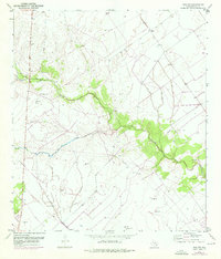
1951 Map of Inez NW
USGS Topo · Published 1976About this map
Garcitas Creek winds through the coastal plains of Victoria County, marking a landscape defined by ranching and early petroleum development. In this mid-century period, the area around Salem remained sparsely settled, with the small community centered near the intersection of various utility corridors. The map records the infrastructure of the burgeoning Texas energy sector, from the Gas Collecting Station and scattered Gas Wells to the network of pipelines that cut across the terrain.
Find a feature on this map
14 named features on this map. Tap any name to fly to it.
Don’t see what you’re looking for? This feature index may not catch every label — zoom into the map to look around manually.
Map Details
Editions of this 1951 Inez NW Map
2 editions found
Other maps of this area

1951 · Inez NW
USGS Topo · 1:24,000

1951 · Inez
USGS Topo · 1:24,000

1952 · Marcado Creek
USGS Topo · 1:24,000

1952 · Victoria East
USGS Topo · 1:24,000

1953 · Beeville
USGS Topo · 1:250,000

1953 · Seguin
USGS Topo · 1:250,000

1956 · Beeville
USGS Topo · 1:250,000

1958 · Seguin
USGS Topo · 1:250,000

1960 · Beeville
USGS Topo · 1:250,000

1963 · Fordtran
USGS Topo · 1:24,000