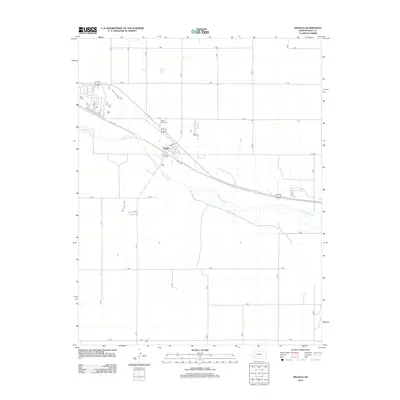
2012 Map of Ingalls
USGS Topo · Published 2012About this map
Arkansas River hydrology and the grid-iron geometry of western Kansas define this 2012 survey. The town of Ingalls serves as the focal point, situated where the river bends south of the rail-and-road corridor. Local history is anchored at the Ingalls - Logan Cem and the central Po, while the surrounding landscape is partitioned by a strict sequence of numbered and lettered rural roads, such as 14 RD and J RD. The presence of Soule Ave and Main St provides a clear view of the settlement's core, illustrating the spatial relationship between the river valley and the agricultural uplands at the start of the twenty-first century.
Find a feature on this map
22 named features on this map. Tap any name to fly to it.
Don’t see what you’re looking for? This feature index may not catch every label — zoom into the map to look around manually.
Map Details
Editions of this 2012 Ingalls Map
This is the sole edition of this map. No revisions or reprints were ever made.
Other maps of this area

1892 · Dodge
USGS Topo · 1:125,000

1896 · Garden
USGS Topo · 1:125,000

1955 · Dodge City
USGS Topo · 1:250,000

1958 · Dodge City
USGS Topo · 1:250,000

1959 · Dodge City
USGS Topo · 1:250,000

1968 · Cimarron NW
USGS Topo · 1:24,000

1968 · Ingalls
USGS Topo · 1:24,000

1968 · Montezuma NW
USGS Topo · 1:24,000

1968 · Cimarron
USGS Topo · 1:24,000

1968 · Cimarron NE
USGS Topo · 1:24,000