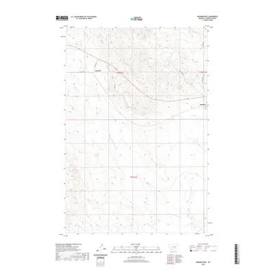
2020 Map of Ingomar West
USGS Topo · Published 2020About this map
Ingomar and Galbraith are the primary points of settlement in this northern section of the Montana high plains, where the landscape is defined by the branching drainage systems of the Rosebud County rangeland. The hydrology is dominated by the descriptively named Froze-to-Death Creek, with its Middle Fork, East Fork, and West Fork carving across the terrain. A sparse but essential network of rural routes, such as Galbirth Rd and Sun Coulee Rd, connects isolated ranches and homesteads. The southern reaches are marked by the presence of Willow Creek, which winds through the lower sections of the quadrangle. This layout reflects the enduring ranching economy of the region, where roads and small settlements follow the logic of the local water sources and coulees.
Find a feature on this map
15 named features on this map. Tap any name to fly to it.
Don’t see what you’re looking for? This feature index may not catch every label — zoom into the map to look around manually.
Map Details
Editions of this 2020 Ingomar West Map
This is the sole edition of this map. No revisions or reprints were ever made.
Other maps of this area

1954 · Forsyth
USGS Topo · 1:250,000

1957 · Forsyth
USGS Topo · 1:250,000

1958 · Forsyth
USGS Topo · 1:250,000

1960 · Steie Ranch
USGS Topo · 1:24,000

1960 · Yablonski Ranch
USGS Topo · 1:24,000

1960 · Ingomar West
USGS Topo · 1:24,000

1960 · Ingomar East
USGS Topo · 1:24,000

1960 · Black Sea Reservoir
USGS Topo · 1:24,000

1960 · Mc Konkey Creek
USGS Topo · 1:24,000

1962 · Sumatra
USGS Topo · 1:24,000