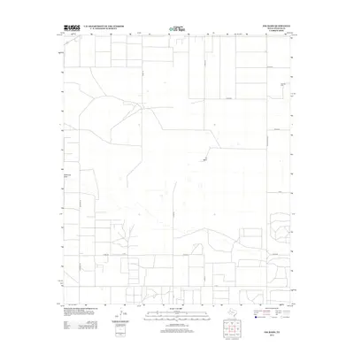
2012 Map of Ink Basin
USGS Topo · Published 2012About this map
West Oil Field sits in the northeastern corner of this West Texas landscape, marking the industrial footprint of energy production in Yoakum County. The terrain is defined by the shallow depressions and drainage patterns of the Llano Estacado, most notably the natural catchment of Ink Basin and the meandering path of McKenzie Draw. A structured grid of rural roads, including Edwards Rd and Ranch Road 1622, provides access to the sparse ranching and petroleum sites that dot the high plains. The map reflects a modern era of land management where traditional cattle country and modern oil extraction coexist along precisely surveyed section lines and county roads like Dixon Rd.
Find a feature on this map
17 named features on this map. Tap any name to fly to it.
Don’t see what you’re looking for? This feature index may not catch every label — zoom into the map to look around manually.
Map Details
Editions of this 2012 Ink Basin Map
This is the sole edition of this map. No revisions or reprints were ever made.
Other maps of this area

1954 · Hobbs
USGS Topo · 1:250,000

1954 · Brownfield
USGS Topo · 1:250,000

1958 · Brownfield
USGS Topo · 1:250,000

1958 · Hobbs
USGS Topo · 1:250,000

1962 · Brownfield
USGS Topo · 1:250,000
1969 · Humble City NE
USGS Topo · 1:24,000
1970 · Prairieview NE
USGS Topo · 1:24,000
1970 · Prairieview SE
USGS Topo · 1:24,000
1971 · Plains NW
USGS Topo · 1:24,000
1971 · Higginbotham
USGS Topo · 1:24,000