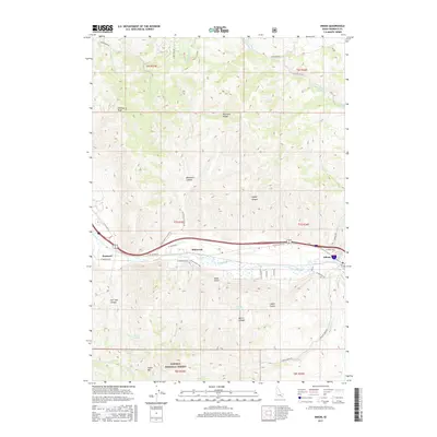
2017 Map of Inkom
USGS Topo · Published 2017About this map
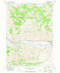
Inkom and Blackrock sit within a dramatic topographic corridor defined by the Pocatello Range and the winding Portneuf River. This landscape is marked by the transition from river valley floors to the high elevations of the Caribou National Forest, where peaks like Chinese Peak and Indian Mtn rise above deep drainage systems such as Blackrock Canyon and Caddy Canyon. The map details the hydrology of the region, featuring numerous named water sources like Fort Hall Spring, Munn Spring, and Morris Canyon Spring, which supported the early development of these southeast Idaho communities. The alignment of W Old Highway 91 and modern transit routes through the valley demonstrates how the natural gap between the mountains has dictated regional movement for generations, connecting Portneuf to the wider valley floor.
Find a feature on this map
43 named features on this map. Tap any name to fly to it.
Don’t see what you’re looking for? This feature index may not catch every label — zoom into the map to look around manually.
Map Details
Editions of this 2017 Inkom Map
This is the sole edition of this map. No revisions or reprints were ever made.
Other maps of this area

1937 · Pocatello
USGS Topo · 1:48,000

1944 · Pocatello
USGS Topo · 1:62,500

1954 · Pocatello
USGS Topo · 1:250,000

1958 · Pocatello
USGS Topo · 1:250,000

1968 · Clifton Creek
USGS Topo · 1:24,000
1968 · South Putnam Mtn
USGS Topo · 1:24,000
1968 · Bonneville Peak
USGS Topo · 1:24,000

1968 · Mc Cammon
USGS Topo · 1:24,000
1968 · Scout Mtn
USGS Topo · 1:24,000
1971 · Inkom
USGS Topo · 1:24,000