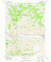
1971 Map of Inkom
USGS Topo · Published 1974About this map
The Portneuf River valley serves as a critical transportation corridor in this Idaho landscape, where the Union Pacific railroad and major roadways parallel the water's course. The settlement of Inkom anchors the eastern edge of the valley, while the smaller community of Blackrock sits further west. This area exhibits a distinct transition from the industrial and transit-heavy river bottom to the high elevations of the Pocatello Range and Caribou National Forest.
Find a feature on this map
42 named features on this map. Tap any name to fly to it.
Don’t see what you’re looking for? This feature index may not catch every label — zoom into the map to look around manually.
Map Details
Editions of this 1971 Inkom Map
2 editions found
Other maps of this area

1937 · Pocatello
USGS Topo · 1:48,000

1944 · Pocatello
USGS Topo · 1:62,500

1954 · Pocatello
USGS Topo · 1:250,000

1958 · Pocatello
USGS Topo · 1:250,000

1968 · Clifton Creek
USGS Topo · 1:24,000
1968 · South Putnam Mtn
USGS Topo · 1:24,000
1968 · Bonneville Peak
USGS Topo · 1:24,000

1968 · Mc Cammon
USGS Topo · 1:24,000
1968 · Scout Mtn
USGS Topo · 1:24,000
1971 · Pocatello North
USGS Topo · 1:24,000