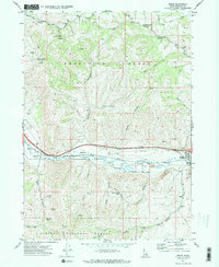
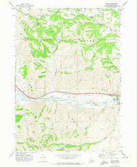
1971 Map of Inkom
USGS Topo · Published 1974About this map
The Pocatello Range dominates the northern half of this landscape, where high-elevation landmarks like Chinks Peak and the Silver Sage Girl Scout Camp overlook the valley below. To the south, the Caribou National Forest covers the terrain, carved by Papoose Creek and Indian Creek. Central to the map is the industrial and transportation corridor following the Portneuf River. This corridor facilitates the Union Pacific railroad and a major pipeline, linking the small settlements of Inkom, Blackrock, and Portneuf. The map details a heavy-industry presence through numerous gravel pits, a borrow pit, and the Fort Hall Mine in Fort Hall Canyon. Recreation and utility features are well-documented, including an Ice Skating Rink near the northern peaks and several identified water sources like Munn Spring and Morris Canyon Spring, which supported the area's local needs during the early 1970s.
Find a feature on this map
36 named features on this map. Tap any name to fly to it.
Don’t see what you’re looking for? This feature index may not catch every label — zoom into the map to look around manually.
Map Details
Editions of this 1971 Inkom Map
2 editions found
Other maps of this area

1937 · Pocatello
USGS Topo · 1:48,000

1944 · Pocatello
USGS Topo · 1:62,500

1954 · Pocatello
USGS Topo · 1:250,000

1958 · Pocatello
USGS Topo · 1:250,000

1968 · Clifton Creek
USGS Topo · 1:24,000
1968 · South Putnam Mtn
USGS Topo · 1:24,000
1968 · Bonneville Peak
USGS Topo · 1:24,000

1968 · Mc Cammon
USGS Topo · 1:24,000
1968 · Scout Mtn
USGS Topo · 1:24,000
1971 · Inkom
USGS Topo · 1:24,000