
1968 Map of Mc Cammon
USGS Topo · Published 1973About this map
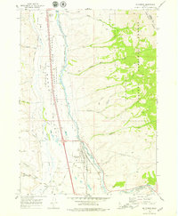
McCammon serves as the central hub of this late-1960s Idaho landscape, positioned at the critical junction of the Union Pacific railroad and the Portneuf River. The map reveals a complex water management system, where the Portneuf Marsh Valley Canal and Marsh Creek traverse the wide floor of Marsh Valley. To the east, the terrain rises sharply into the Caribou Range and the Caribou National Forest, carved by numerous drainages like Robbers Roost Creek and Harkness Creek.
Find a feature on this map
35 named features on this map. Tap any name to fly to it.
Don’t see what you’re looking for? This feature index may not catch every label — zoom into the map to look around manually.
Map Details
Editions of this 1968 Mc Cammon Map
2 editions found
Other maps of this area

1937 · Pocatello
USGS Topo · 1:48,000

1944 · Pocatello
USGS Topo · 1:62,500

1954 · Pocatello
USGS Topo · 1:250,000

1958 · Pocatello
USGS Topo · 1:250,000

1968 · Bear Camp Gulch
USGS Topo · 1:24,000

1968 · Hawkins
USGS Topo · 1:24,000

1968 · Lava Hot Springs
USGS Topo · 1:24,000
1968 · Arimo
USGS Topo · 1:24,000
1968 · Bonneville Peak
USGS Topo · 1:24,000
1968 · Haystack Mtn
USGS Topo · 1:24,000