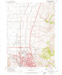
1971 Map of Pocatello North
USGS Topo · Published 1974About this map
The Fort Hall Indian Reservation Boundary defines the northern landscape of this region, where the high desert meets the irrigated plains of the Snake River Plain. In the early 1970s, the agricultural character of Tyhee is starkly contrasted by the rapid suburbanization of Chubbuck and the northern reaches of Pocatello. The complex irrigation network, including the Fort Hall Main Canal and the Tyhee Wasteway, underpins the local economy, while the Union Pacific railroad and the newly constructed Interstate 15 corridor facilitate regional transit. Cultural and civic life is centered around local landmarks such as the County Fairgrounds, Highland High School, and the Drive-in Theater. To the east, the terrain rises sharply into the Pocatello Range, with the Pocatello Bench serving as a prominent geographical feature overlooking the Portneuf River valley.
Find a feature on this map
89 named features on this map. Tap any name to fly to it.
Don’t see what you’re looking for? This feature index may not catch every label — zoom into the map to look around manually.
Map Details
Editions of this 1971 Pocatello North Map
2 editions found
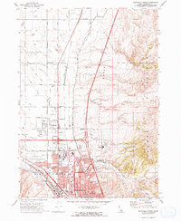
Other maps of this area

1934 · Michaud
USGS Topo · 1:62,500

1937 · Pocatello
USGS Topo · 1:48,000

1937 · Michaud
USGS Topo · 1:62,500

1940 · Blackfoot
USGS Topo · 1:62,500

1943 · Blackfoot
USGS Topo · 1:62,500

1944 · Pocatello
USGS Topo · 1:62,500

1954 · Pocatello
USGS Topo · 1:250,000

1955 · Pingree
USGS Topo · 1:24,000

1955 · Idaho Falls
USGS Topo · 1:250,000

1958 · Idaho Falls
USGS Topo · 1:250,000