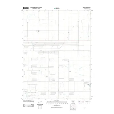
2011 Map of Inland
USGS Topo · Published 2011About this map
Inland serves as a focal point for this section of Clay County, defined by a rigid grid of agricultural roads and the essential presence of the Inland Post Office. This landscape, characteristic of south-central Nebraska, is drained by the winding courses of School Creek, Little Sandy Creek, and Big Sandy Creek. These waterways provide the only natural deviation from the rectilinear survey lines that govern the region. For those researching local heritage, the map identifies two significant burial sites: the Glenvil Cemetery to the southwest and Zion Cemetery further east. The map also documents the transport infrastructure of the early 21st century, showing the connection between rural section roads and State Spur 18D, reflecting the enduring organization of the plains' farming communities.
Find a feature on this map
24 named features on this map. Tap any name to fly to it.
Don’t see what you’re looking for? This feature index may not catch every label — zoom into the map to look around manually.
Map Details
Editions of this 2011 Inland Map
This is the sole edition of this map. No revisions or reprints were ever made.
Other maps of this area

1898 · Superior
USGS Topo · 1:125,000

1898 · Grand Island
USGS Topo · 1:125,000

1955 · Grand Island
USGS Topo · 1:250,000

1957 · Grand Island
USGS Topo · 1:250,000

1958 · Grand Island
USGS Topo · 1:250,000

1969 · Hastings East
USGS Topo · 1:24,000

1969 · Fairfield NW
USGS Topo · 1:24,000
1969 · Trumbull
USGS Topo · 1:24,000
1969 · Fairfield
USGS Topo · 1:24,000
1969 · Harvard NE
USGS Topo · 1:24,000