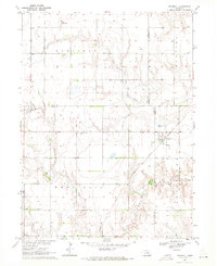
1969 Map of Trumbull
USGS Topo · Published 1971About this map
The agricultural landscape of south-central Nebraska is meticulously documented in this 1969 field check, where the village of Trumbull sits at the intersection of four counties: Adams, Clay, Hall, and Hamilton. The map illustrates a region defined by its reliance on water and rail, with the Union Pacific line running through the small settlement of Hansen in the west and the Burlington Northern cutting diagonally through the east.
Find a feature on this map
18 named features on this map. Tap any name to fly to it.
Don’t see what you’re looking for? This feature index may not catch every label — zoom into the map to look around manually.
Map Details
Editions of this 1969 Trumbull Map
This is the sole edition of this map. No revisions or reprints were ever made.
Other maps of this area

1892 · Grand Island
USGS Topo · 1:62,500

1895 · Grand Island
USGS Topo · 1:62,500

1898 · Grand Island
USGS Topo · 1:125,000

1955 · Grand Island
USGS Topo · 1:250,000

1957 · Grand Island
USGS Topo · 1:250,000

1958 · Grand Island
USGS Topo · 1:250,000
1962 · Doniphan
USGS Topo · 1:24,000
1962 · Alda
USGS Topo · 1:24,000
1967 · Giltner
USGS Topo · 1:24,000

1969 · Hastings East
USGS Topo · 1:24,000